
A featured contribution from Leadership Perspectives, a curated forum for enterprise technology leaders, nominated by our subscribers and vetted by the CIOApplications Editorial Board.

Maser Consulting P.A.
Optimizing Asset Management Using GIS

Here’s how it works
In an average municipal setting, there are thousands of infrastructure assets that need to be monitored and managed for the duration of their life cycle. This includes anything from vehicle fleets to manhole covers. Traditionally, to gain information about assets spread throughout the community parameters, conventional boots-on-the ground survey methods were used to collect asset information in the field. Hand written field books were used to describe features with station and offsets to a set surveyed baseline. As the maps were hand-drawn from this information, corresponding tables were typed out showing coordinate locations (x,y,z), materials of those assets, and sizes of pipes. These maps and tables were stored in a manageable fashion, either rolled up in tubes or in space-eating flat files. Detailed asset maps had corresponding key maps showing the spatial location of each feature and could entail upwards of 200 detailed sheets. This is a clumsy system when compared with a fully electronic version.
Take property maps for instance. Towns have a survey map of every single property within their limits. This information might be stored in a file cabinet, computer, or both. Gathering all of this data into the same room at the same time in order to schedule a repair or access information could take a long time.
However, once these paper maps have been transferred digitally for use in a GIS software platform, each property comes to life! Clicking on individual properties gives you access to information about the land parcel that is virtually limitless because GIS programs are customizable to include any amount of information you need to maintain that asset.
Today’s GIS programs are web-based which gives end-users the capability to store a large amount of data within a secure web server
GIS at its best is built on a system of map layers. Once you have an interactive base map, you can overlay information about the corresponding street system that might show the location of fire hydrants, storm drains, outfalls, stop signs, etc. Details about each of these assets can be accessed via standard drop down lists, enabling field staff to select asset characteristics such as the manufacturer, condition, repair history, replacement scheduling, service requests, and who performed the work. Even the screws used to hold them in place can all be tracked by this geo database management application. Having this information readily at your fingertips greatly expedites scheduling service requests and workflows. And it gets better.
Field to Office
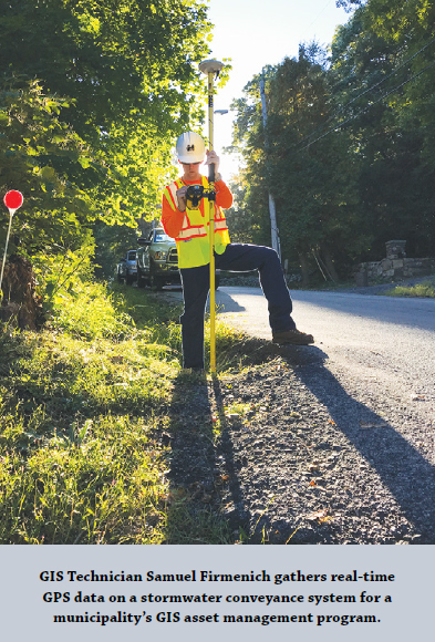
Today’s GIS programs are web-based which gives end-users the capability to store a large amount of data within a secure web server (the cloud), enables field staff to verify the location of the asset and enter or edit current details about it upon visual inspection directly into the system in real time. It also can be configured to enable staff to launch live service requests, manage, and report on the status of those work assignments directly from the field. It is also immediately accessible by office staff. This has been a game-changer.
 Because GIS captures data related to positions on the earth’s surface, it can also provide aerial imagery. Having an accurate snapshot of your asset location stored on the cloud before a disaster occurs, such as a hurricane or severe flooding, can help expedite post storm repairs because you have an exact record of what previously existed. Even if fire or flooding were to destroy original documents and computer files, having them stored in the web-based GIS server cloud would keep them safely intact. GIS programs are also a valuable tool because they offer design tools for the creation of construction documents and as-built plans.
Conclusion
Using GIS asset management solutions provides one access point for viewing, maintaining, and managing your assets. While the initial implementation of a GIS application takes a little leg work to set up, once it is up and running, it is well worth the investment to have the depth of detail regarding your assets and an improvement in your ability to manage them.

