
A featured contribution from Leadership Perspectives, a curated forum for enterprise technology leaders, nominated by our subscribers and vetted by the CIOApplications Editorial Board.

McKim & Creed
Navigating The Future: Geospatial Technologys Impact On Transportation Design

Liberating Data from Siloed Systems Using BIM
BIM technology has revolutionized the transportation sector by serving as a collaborative tool that expedites design processes. Integrated with geospatial technology, BIM facilitates enhanced collaboration and coordination among stakeholders, including engineers, architects, and planners. The three-dimensional visualization capabilities of BIM enable stakeholders to make informed decisions, explore design alternatives, and identify and resolve conflicts in real time, significantly reducing the time spent on design iterations.
The rapid pace of technological change necessitates a culture of continuous learning and adaptability within construction teams
Getting Geospatial Data into a Common Data Environment (CDE)
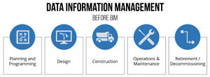 Source data can create significant headaches if the data quality and positional accuracies are not managed and governed. Proper data governance and data ‘scrubbing’ are required to maximize the effectiveness of the CDE and move into geospatial analysis and analytics. Integrating geospatial data into a CDE represents a pivotal advancement in transportation design. This approach fosters collaboration and communication and addresses critical challenges like version control, traceability, and data security. As the transportation sector embraces digital transformation, leveraging a CDE for geospatial data will become indispensable.
 Using Geospatial Technology for Transportation Risk Assessment and Resilience
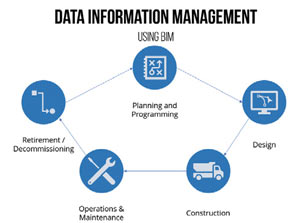 Given the essential role of transportation systems in an emergency response situation, the nation has become more reliant on the overall resiliency of transportation networks. Geospatial technology plays a pivotal role in identifying and analyzing risks associated with transportation infrastructure. By integrating real-time data feeds and historical information, GIS tools can pinpoint vulnerable areas, assess natural disaster risks, and identify potential disruptions to transportation networks. Story maps of historic geospatial data can help engineers and planners integrate design elements to restore normal operations faster in a post-event situation. As the transportation sector evolves, the integration of geospatial technology for risk assessment and resilience becomes a fundamental strategy for ensuring the longevity and reliability of transportation systems in the face of an ever-changing environment.
Changing the Dynamics of Design and Construction
The integration of geospatial technology into transportation design represents a paradigm shift, offering unprecedented levels of collaboration, efficiency, and sustainability. From real-time data integration and digitalization, geospatial technology is shaping the future of transportation infrastructure. As the industry continues to embrace these advancements, we can expect designs that are efficient, sustainable, and responsive to the evolving needs of our dynamic world. The road ahead is paved with innovation, and geospatial technology is steering the way.

